


Piloting the MOLE presents an immediate and formidable challenge, where cryptic directives serve as the sole compass through an unknown subterranean landscape. The weight of Earth’s survival rests upon the navigator’s ability to decipher these enigmatic clues, placing a profound responsibility squarely on the player. This detailed guide aims to demystify the intricate processes of acquiring coordinates and plotting a course within the high-stakes environment of MOLE.
The Critical Mission: Understanding the MOLE’s Purpose
The MOLE, a sophisticated drilling and navigation apparatus, is not merely a game mechanic but a representation of humanity’s desperate efforts to secure vital resources or escape an endangered terrestrial surface. While the specific existential threat remains shrouded in the game’s narrative, the operational imperative is clear: the MOLE must traverse the Earth’s crust, uncovering critical data and potentially identifying new frontiers for survival. Each successful navigation not only advances the player’s progress but symbolically represents a small victory in a much larger, unnamed conflict. The game’s core loop of deciphering seismic data, plotting trajectories, and executing precise drilling maneuvers mirrors the complex planning and execution required in real-world deep-earth exploration and resource management.
Phase One: Initial Coordinate Acquisition and Data Decryption
The initial stages of operating the MOLE are characterized by a reliance on the Navigation Cassette, the primary tool for gathering subterranean intelligence. This process unfolds within the MOLE’s Cockpit, a cramped but functional control center.
Locating and Processing Seismic Data
Upon entering the Cockpit, players will find a primary terminal to their immediate left. This console is equipped with a small display screen, a control lever, and an insertion slot for the Navigation Cassette. The first step in acquiring coordinates involves inserting the Navigation Cassette into this terminal. Once inserted, the lever must be pulled to initiate the upload of seismic data. A progress bar on the display indicates the data transfer status, and the cassette should only be removed once this bar reaches its full 100 percent. This initial data capture is crucial, as it forms the raw material for all subsequent navigation calculations.
Following the seismic data upload, the player must then turn to the computer terminal positioned opposite the initial console. Interacting with this terminal and pressing the Spacebar initiates the decryption process. This is where the raw seismic data is transformed into usable navigational information. The decrypted data then needs to be processed further.
Translating Data into Navigational Coordinates
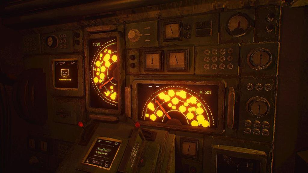
The decrypted data is then transferred to the main console located on the left wall of the Cockpit. This console features two smaller levers and displays above them. The objective here is to precisely position these levers within the designated "empty spaces" on the displays. This is not a random process; players must carefully analyze the visual representation of the subsurface, avoiding areas marked as "rock clusters." The levers are manipulated to create a straight path, indicated by an arrow, through these empty spaces. Successfully aligning the levers in this manner yields the Y and X coordinates for the MOLE’s intended trajectory. These numerical values are then inputted into the keypads situated at the pilot’s seat, a process initiated by pulling a prominent red handle. The accuracy of this input is paramount, as it directly dictates the MOLE’s initial course.
Phase Two: Optimizing Drill Performance Through Terrain Analysis
With the coordinates locked in, the next critical phase involves calibrating the MOLE’s drilling speed to match the encountered subterranean conditions. This is where the Ground Density Chart becomes an indispensable resource.
Interpreting Terrain Density for Optimal Speed
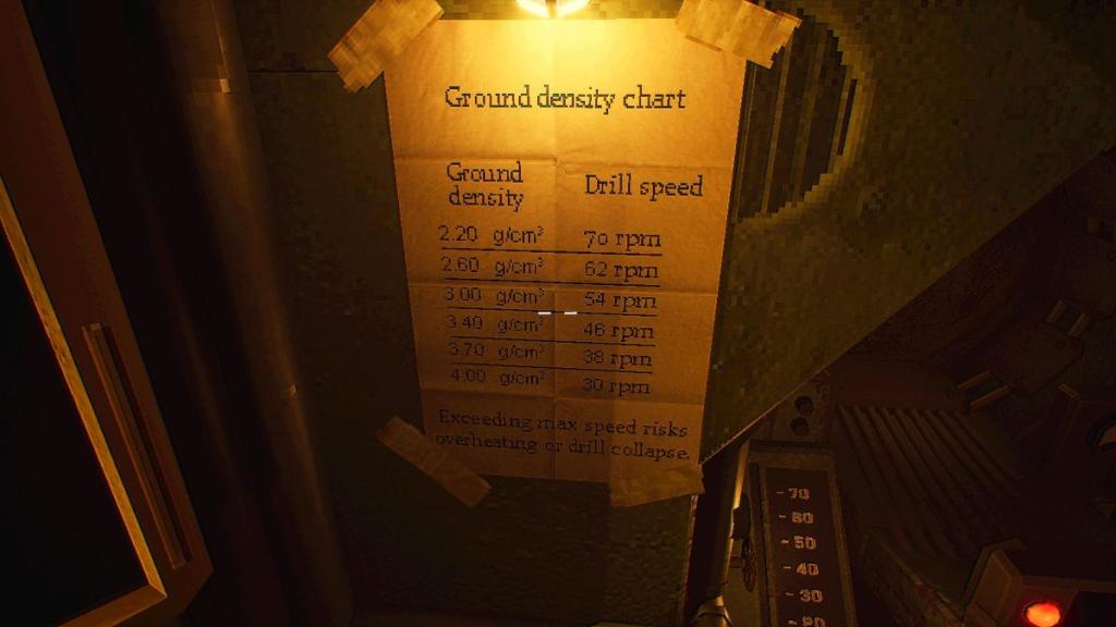
Returning to the console with the two small levers, players can now access information regarding the Terrain Density. This data is presented in units of grams per cubic centimeter (g/cm³). To translate this geological measurement into an appropriate drilling speed, players must consult the Ground Density Chart, typically located adjacent to the pilot’s seat. This chart provides a correlation between density values and the recommended drill speed settings.
It is important to note that the encountered density may not always correspond precisely to a listed drill speed. In such instances, players are required to make an informed adjustment, selecting the closest compatible speed or interpolating between values. This chart must be referenced every time a new set of coordinates is acquired, as subterranean conditions can vary significantly, demanding constant recalibration of the MOLE’s operational parameters. Failure to properly calibrate the drill speed can lead to inefficiencies, increased wear on the MOLE, or even navigational hazards.
Executing the Drill Maneuver
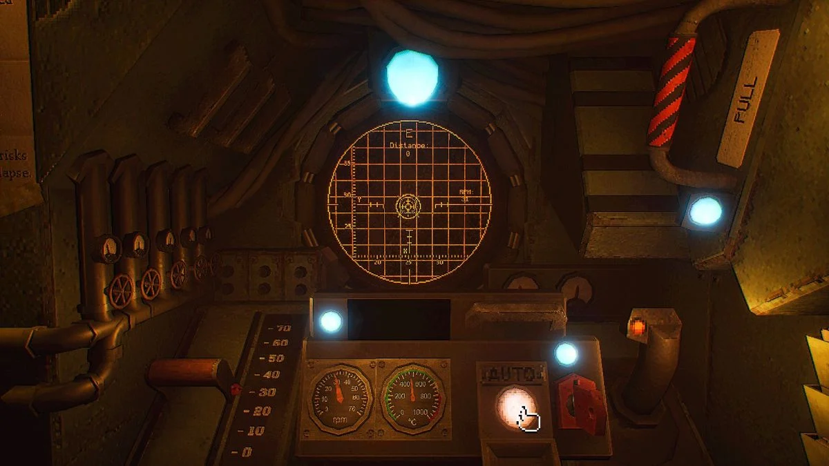
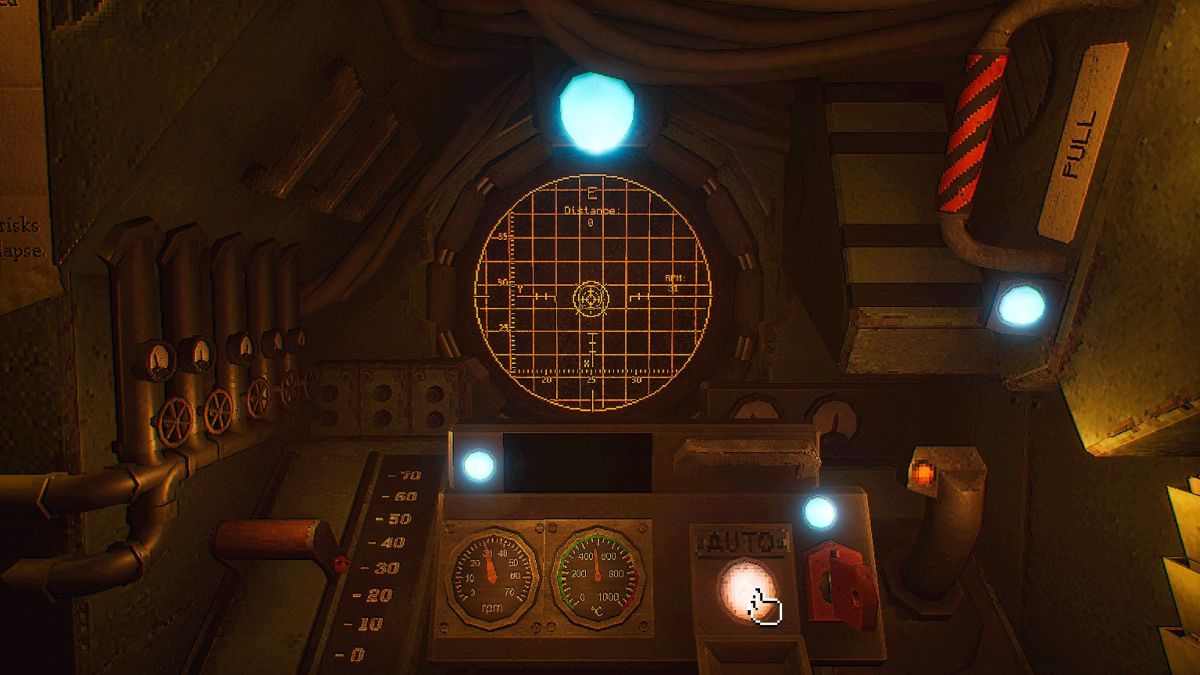
Once the drill speed is set, the player returns to the pilot’s seat. The speed itself is adjusted using the red lever situated on the left side of the seat. Piloting the MOLE is accomplished using the navigation stick located on the right. The objective is to guide the MOLE along the grid displayed ahead, following the on-screen arrow until the "piloting circle" aligns perfectly with the "stationary circle," which represents the target destination. Upon successful alignment, a button prompt will appear, allowing the player to switch to "Auto" mode, signifying the completion of this navigational segment. This transition to automated piloting marks a significant step in the MOLE’s journey, allowing for more efficient and potentially longer-range travel.
Phase Three: Advanced Navigation with the Targeting Cassette
As the mission progresses, typically on the second day of operation, the "Lab" facility becomes accessible, introducing a new layer of complexity and capability through the Targeting Cassette.
The Role of the Targeting Cassette
Beyond the Navigation Cassette, which is solely dedicated to seismic data acquisition, the MOLE utilizes a second critical component: the Targeting Cassette. This cassette is designed to gather new data related to the "Signal," a mysterious and potentially crucial element within the game’s narrative. Its integration into the piloting process signifies an evolution in the mission’s objectives, moving beyond simple traversal to active signal engagement.
Utilizing the Targeting Cassette for Signal Acquisition
To employ the Targeting Cassette, players must first retrieve a crystal from the Geologist’s workstation. This crystal is then placed onto a motherboard located beneath a monitor displaying the "White Rabbit Signal." With the lights in the Lab turned off, players interact with the Signal. This interaction is visualized as beams of light encircling a portion of the player’s vision, indicating the acquisition of sensory data related to the signal.
Subsequently, with the lights still off, players must interact with the grid located on the wall behind them. This action reveals a radio frequency, displayed visually on the grid. Once the lights are switched back on, the Targeting Cassette is inserted into the radio console. The cassette’s tuning is then adjusted using two knobs: the top knob controls the first two digits of the frequency, while the bottom knob manages the subsequent three digits. A small lever with a red light beneath it is then pulled to finalize the tuning process, locking onto the specific signal frequency.
Integrating Signal Data into Navigation
The data acquired through the Targeting Cassette is not directly used for piloting the drill. Instead, players must return to the Cockpit and utilize the computer terminal to convert this signal data into usable coordinates. This conversion process involves selecting three ".xyx" files from a list of options by pressing the Spacebar. After all three files are selected, pressing Enter twice completes the conversion. These newly generated coordinates are then integrated into the standard navigation process. Players can then proceed to use the Navigation Cassette and follow the previously outlined method to pilot the drill to these new destinations, effectively linking the analysis of the mysterious "Signal" with the physical movement of the MOLE.
Broader Implications and Future Considerations
The intricate gameplay mechanics of MOLE serve as a compelling simulation of complex technological operations. The reliance on precise data interpretation, calibrated adjustments, and methodical execution highlights the challenges inherent in deep-earth exploration and advanced navigation. The narrative progression, marked by the introduction of new tools and objectives like the Targeting Cassette, suggests an evolving mission profile, potentially involving the detection and analysis of extraterrestrial signals or the identification of vital subterranean resources necessary for humanity’s long-term survival.
The game’s design emphasizes a systematic approach to problem-solving, where each step, from decrypting seismic data to fine-tuning drill speeds, contributes to the overarching goal. This mirrors the meticulous planning and iterative refinement required in real-world scientific and engineering endeavors. As players master these mechanics, they gain a deeper appreciation for the complexities involved in navigating and operating within extreme environments, underscoring the critical role of precise data and technological prowess in humanity’s ongoing quest for survival and advancement. The continuous cycle of data acquisition, analysis, and execution within MOLE provides a unique and engaging perspective on the challenges and triumphs of deep subterranean exploration.