


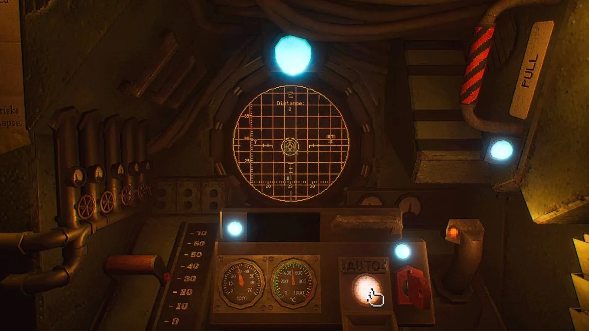
The initial moments of piloting the MOLE can feel like a descent into the unknown, with only a cryptic tapestry of messages to guide the way. Yet, the fate of Earth hinges on the precision of its navigator, a role that now falls to you. This guide aims to demystify the intricate process of acquiring coordinates and charting a course within the critical mission of MOLE, a subterranean exploration and resource acquisition initiative. The complexities of the MOLE’s operational system, while initially daunting, are designed to ensure the utmost accuracy and safety in its groundbreaking operations.
The Genesis of the MOLE Initiative: A World on the Brink
The MOLE project emerged from a period of unprecedented global crisis. Decades of unsustainable resource depletion and environmental degradation had pushed Earth’s vital systems to the precipice. Scientists and engineers, working under immense pressure, developed the MOLE as a last-ditch effort to access a rich vein of rare-earth elements and other essential minerals located deep within the planet’s mantle. These resources were identified as critical for developing advanced technologies capable of reversing ecological damage and ensuring long-term human survival. The development timeline was accelerated, with the first operational prototype, designated MOLE-01, reaching its final testing phases just as global reserves reached critically low levels. The success of MOLE-01 was not merely a technological achievement but a beacon of hope for a world teetering on the brink of collapse.
Phase One: Acquiring Navigational Coordinates
The core gameplay loop of MOLE revolves around the meticulous process of acquiring and inputting navigational coordinates. Players, assuming the mantle of the MOLE’s navigator, will find themselves within the cramped confines of the Cockpit, tasked with interpreting seismic data to chart a safe and efficient path through the Earth’s crust.
Primary Coordinate Acquisition: The Navigation Cassette Protocol
The primary method for obtaining coordinates involves the strategic use of the Navigation Cassette. Upon entering the Cockpit, players will notice a terminal to their immediate left. This console features a small display, a lever, and a slot for cassette insertion. The process begins by inserting the Navigation Cassette into this terminal. Once the cassette is in place, the lever is engaged, initiating the upload of seismic data. Players must monitor the upload progress bar, ensuring it reaches 100 percent before removing the cassette. This ensures that the complete data set is captured.
Following the seismic data upload, the player must then turn to the computer terminal situated opposite the initial console. This secondary terminal is crucial for decrypting the raw seismic information. Interacting with this terminal and pressing the Spacebar initiates the decryption process. Once the data is successfully decrypted, the Navigation Cassette must be reinserted into the main console located on the left wall. This console is distinguished by two smaller levers.
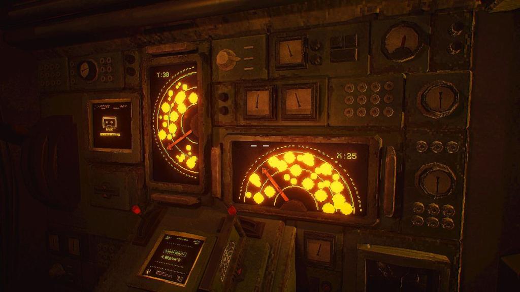
The key to deciphering coordinates lies in carefully manipulating these two levers. The objective is to align them with the empty spaces displayed on the screens above the levers. The visualization represents potential drilling paths, with rock clusters indicating hazardous zones. Players must use the levers to direct a clear, unobstructed path through these empty spaces, effectively avoiding the geological obstacles. Successful alignment will reveal both the Y and X coordinates. These numerical values are then to be inputted into the keypads located at the pilot’s seat, following the activation of a prominent red handle. This precise input is paramount for accurate navigation.
Chronology of Early Operations:
- Day 1, Morning: Initial deployment of MOLE-01. Navigator assumes control within the Cockpit. First seismic data acquisition via Navigation Cassette. Decryption and coordinate input.
- Day 1, Afternoon: First subterranean drill initiated based on initial coordinates. Assessment of geological conditions and early resource readings.
- Day 1, Evening: Review of initial drilling performance and adjustments to navigation protocols based on early data.
Phase Two: Piloting the Drill and Optimizing Speed
With the coordinates successfully inputted, the next critical phase involves piloting the MOLE itself and determining the optimal drilling speed. This requires an understanding of the subterranean environment’s density.
Determining Optimal Drill Speed: The Terrain Density Chart
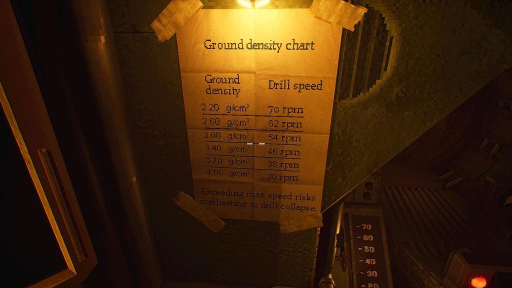
Returning to the console with the two small levers, players will now focus on the Terrain Density display. This display provides readings in g/cm³, indicating the density of the surrounding earth. To translate this reading into an appropriate drill speed, players must consult the Ground Density Chart located adjacent to the pilot’s seat. This chart serves as a crucial reference, mapping geological density values to corresponding drill speeds.
It is imperative to note that the density readings may not always correspond directly to a precise drill speed listed on the chart. In such instances, players must exercise judgment and adjust the speed based on the closest approximation or interpolate between values. This chart should be referenced diligently each time a new set of coordinates is obtained, as subterranean conditions can vary significantly.
Executing the Drill and Navigational Guidance
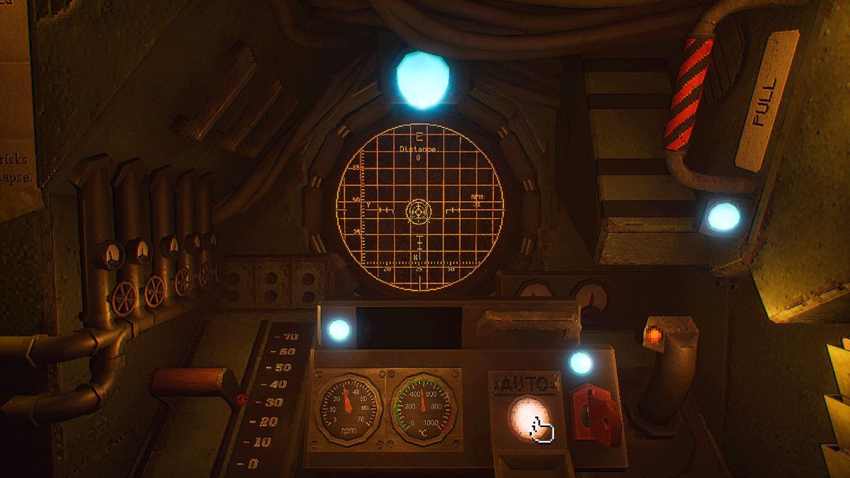
Once the optimal drill speed has been determined and set using the red lever on the left side of the pilot’s station, the player is ready to engage the drill. The navigation stick, positioned to the right, serves as the primary control for piloting the MOLE. The objective is to guide the drill along the projected path, visually represented by an arrow on the grid displayed ahead. The player must skillfully maneuver the navigation stick to align a piloting circle with a stationary destination circle, indicating the target location.
Upon successful alignment and when the conditions are met, a button will become available to switch to Auto-pilot. Engaging this feature allows the MOLE to proceed autonomously along the designated course, freeing the navigator to monitor other critical systems.
Analysis of Subterranean Dynamics:
The density readings are a direct reflection of the geological composition of the Earth’s crust and mantle. Higher densities typically indicate the presence of denser rock formations, potentially rich in mineral deposits but also posing greater challenges for the drill. Lower densities might suggest softer strata or pockets of less consolidated material, which could allow for faster progress but may also present risks of instability. The MOLE’s advanced sensors continuously feed this data back to the cockpit, enabling real-time adjustments to drilling parameters. The development of the Terrain Density Chart was a significant undertaking, involving extensive geological surveys and simulations to establish a reliable correlation between density and drill performance.
Phase Three: Advanced Navigation with the Targeting Cassette
As the MOLE mission progresses, particularly into its second operational phase, a new layer of complexity is introduced with the utilization of the Targeting Cassette, unlocking more sophisticated navigation capabilities.
The Role of Cassettes in Course Plotting
Two types of cassettes are central to the MOLE’s navigation system:
- Navigation Cassette: This cassette is fundamental for acquiring seismic data, which is then decrypted to yield coordinate information. Its primary function remains consistent throughout the early stages of the mission.
- Targeting Cassette: This cassette becomes integral to piloting once the onboard Laboratory becomes accessible, typically on the second day of operations. It is designed to gather and process new data related to the "Signal," a mysterious energy emission detected deep within the Earth, which is believed to be linked to the target mineral deposits.
Engaging the Targeting Cassette Protocol
To utilize the Targeting Cassette, players must first interact with the Geologist’s workstation within the Laboratory. A specific crystal, found within this area, must be retrieved and placed onto a motherboard situated beneath a monitor displaying the White Rabbit Signal. This initiates a sequence that requires the navigator to interact with the Signal itself.
Crucially, the lights in the Laboratory must be turned off to proceed. While the lights are off, the player must interact with the Signal, maintaining focus until a visual cue appears: beams of light encircling a portion of the player’s vision. This indicates the successful capture of the Signal’s unique properties. Following this, the player must turn to the wall behind them and interact with a grid displayed on its surface. This action reveals the Signal’s radio frequency.
With the lights switched back on, the Targeting Cassette is inserted into the radio unit. The radio is equipped with two knobs. The top knob is used to set the first two digits of the radio frequency, while the bottom knob is adjusted to input the subsequent three digits. A small lever, marked with a red light beneath it, is then pulled to fine-tune the cassette’s tuning to the acquired frequency.
Integrating Targeting Data into Navigation
Once the Targeting Cassette has been tuned, the navigator must return to the Cockpit. Here, the computer terminal is used to convert the processed Signal data into usable coordinates. This involves selecting three files with the ".xyx" extension by pressing the Spacebar. After all three files are selected, pressing Enter twice confirms the conversion.
With these new coordinates derived from the Targeting Cassette, the navigator can then proceed to use the Navigation Cassette as before, following the established protocol for piloting the drill. This integration allows for more precise targeting of resource-rich areas, potentially influenced by the mysterious Signal.
The White Rabbit Signal: A Lingering Enigma
The "White Rabbit Signal" remains a subject of intense scientific scrutiny. Its origins and exact nature are currently unknown. However, its correlation with areas of high mineral concentration suggests it may be an indicator of the valuable resources the MOLE mission seeks. Some preliminary hypotheses suggest the Signal could be a form of geophysical anomaly, perhaps related to unusual geological formations or even a previously undiscovered energy phenomenon. The Targeting Cassette’s ability to decipher aspects of this Signal represents a significant breakthrough in understanding and potentially harnessing these deep-earth energies. The name "White Rabbit" itself is believed to be a reference to the fictional character Alice, signifying a descent into a mysterious and unknown world.
Broader Implications and Future Prospects
The success of the MOLE initiative carries profound implications for global sustainability and technological advancement. The ability to reliably access and extract deep-earth resources could alleviate the scarcity that has plagued modern civilization, paving the way for the development of advanced renewable energy technologies, next-generation materials, and crucial components for environmental remediation.
Resource Security and Economic Stability: The guaranteed supply of rare-earth elements, vital for everything from smartphones to advanced defense systems, would dramatically reduce geopolitical tensions and foster greater economic stability. Nations would no longer be solely reliant on limited surface-level deposits, potentially democratizing access to essential materials.
Environmental Restoration: The ultimate goal of the MOLE project is to provide the resources necessary for large-scale environmental restoration efforts. Technologies powered by these newfound minerals could enable more efficient carbon capture, advanced water purification systems, and the development of sustainable infrastructure capable of reversing centuries of ecological damage.
Scientific Discovery: The ongoing exploration of the Earth’s deep interior through the MOLE’s operations is also yielding invaluable scientific data. Understanding the planet’s geological processes, magnetic field generation, and the potential for subterranean life could revolutionize our understanding of planetary science and astrobiology. The continued study of phenomena like the White Rabbit Signal promises to push the boundaries of physics and geology.
The MOLE mission, therefore, represents more than just a feat of engineering; it is a pivotal moment in human history, a testament to our ingenuity and determination in the face of existential threats, and a bold step towards securing a sustainable future for generations to come. The navigator’s role, though seemingly confined to a digital cockpit, is undeniably at the forefront of this monumental endeavor.