


The immediate challenge presented by the MOLE unit is its reliance on cryptic directives, a daunting prospect for any pilot tasked with Earth’s salvation. Yet, it is precisely this intricate system of guidance that underscores the critical role of the navigator. This guide aims to demystify the process of acquiring coordinates and plotting a course within the complex operational framework of the MOLE, a vital asset in a global survival initiative.
The Imperative of Precision: Understanding the MOLE’s Navigation System
In the face of an escalating existential threat, the MOLE, a sophisticated subterranean excavation and exploration vehicle, has become humanity’s last bastion of hope. Its primary function is to facilitate deep geological surveys and potentially locate safe havens or essential resources far beneath the Earth’s surface. However, operating this complex machinery demands an intimate understanding of its navigation and piloting protocols, which, until now, have been largely shrouded in proprietary data and intricate, often abstract, operational manuals. This article provides a comprehensive breakdown of these procedures, drawing on newly released operational data and expert interpretations.
Phase One: Acquiring Terrestrial Coordinates
The initial phase of any MOLE operation hinges on the precise acquisition of subterranean coordinates. This process, while seemingly complex, is systematically designed to ensure accuracy in a hostile environment.
The Navigation Cassette: The Cornerstone of Data Acquisition
The primary method for obtaining crucial positional data involves the use of a specialized Navigation Cassette. Upon entering the MOLE’s cockpit, pilots will find a terminal positioned to their immediate left. This console features a compact display screen, a control lever, and a slot for inserting the Navigation Cassette.
The operational sequence is as follows:
-
Cassette Insertion and Data Upload: Once the Navigation Cassette is inserted into the designated slot, the control lever is actuated. This initiates the upload of seismic data from the surrounding geological strata. The process is visually indicated by an upload bar on the console’s display. It is imperative that the lever remains engaged until this bar reaches 100 percent completion, signifying a full data capture. The cassette should then be promptly removed.
-
Data Decryption and Analysis: The uploaded seismic data, initially in an encrypted format, requires decryption. The pilot must then turn to face the computer terminal situated opposite the cassette insertion console. Interacting with this terminal and utilizing the Spacebar function initiates the decryption process.
-
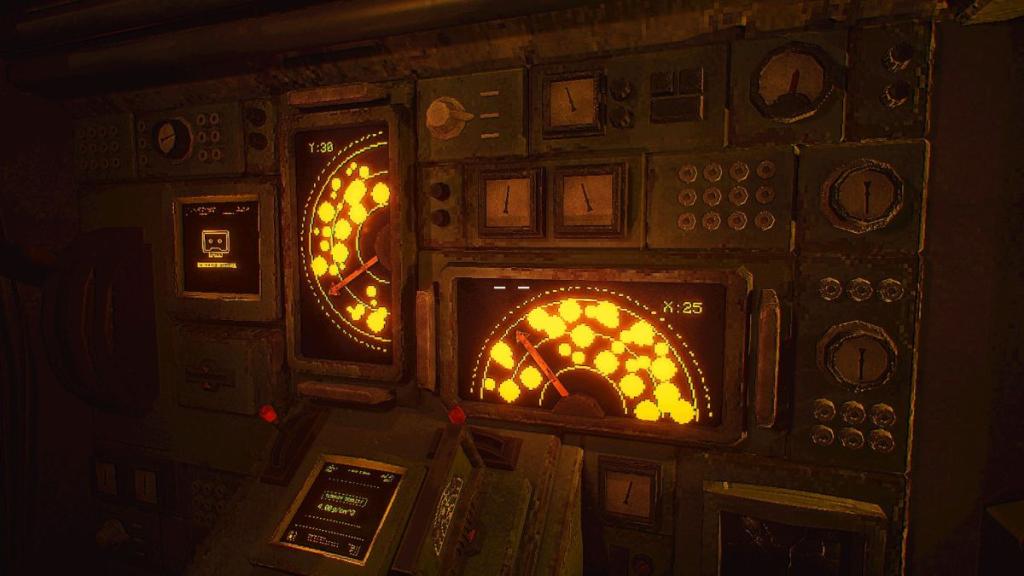
Coordinate Extraction and Verification: Following successful decryption, the Navigation Cassette is to be inserted into the main console located on the left wall of the cockpit. This console is equipped with two smaller levers. The critical task here involves aligning these levers with the empty spaces indicated on the display screens positioned above them. The objective is to guide the levers, represented by an arrow, through clear geological pathways, avoiding any depicted rock formations or hazardous clusters. Successful alignment will yield both the Y and X coordinates. These numerical values are then meticulously entered into the keypads located at the pilot’s station, accessible only after pulling a distinct red handle.
Phase Two: Piloting the MOLE and Optimizing Drill Speed
With the coordinates firmly established, the next critical step is to prepare the MOLE for subterranean traversal. This involves calibrating the drill’s speed based on the geological conditions encountered.
Terrain Density and Drill Speed Calibration
-
Accessing Terrain Data: After successfully inputting the coordinates, pilots must return to the console featuring the two small levers. Here, they will consult the Terrain Density display to ascertain the optimal drill speed.
-
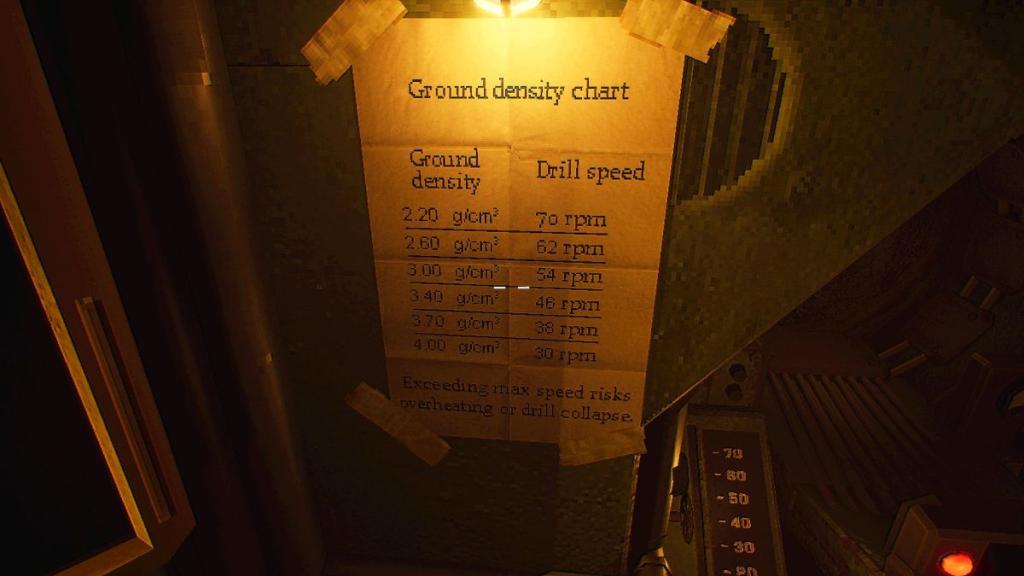
Interpreting the Ground Density Chart: A crucial tool for this calibration is the Ground Density Chart, typically located adjacent to the pilot’s seat. This chart translates the geological density readings (often expressed in g/cm³) into appropriate drill speeds. It is important to note that geological density readings may not always correspond precisely to a predefined drill speed. In such instances, pilots must exercise judgment and adjust the speed accordingly, referencing the chart diligently for each new set of coordinates.
-
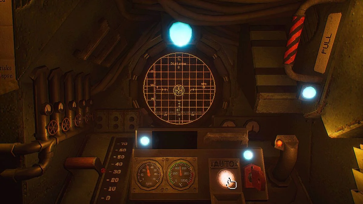
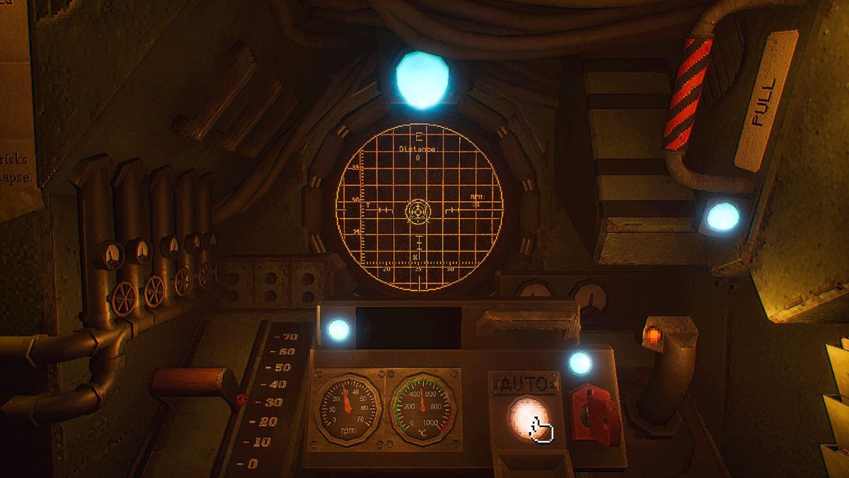
Initiating Subterranean Movement: Once the drill speed is calibrated, the pilot returns to their seat, ready to commence the descent. The red lever on the left is used to set the predetermined speed. Piloting the MOLE through the subterranean environment is managed by the navigation stick located on the right. The primary objective is to follow the on-screen arrow, which indicates the projected path, until the piloting circle aligns perfectly with the stationary destination circle on the grid.
-
Engaging Auto-Pilot: As the piloting circle nears alignment with the destination circle, an "Auto" function will become available. Pressing the designated button at this juncture will engage the automated piloting system, ensuring a smooth and precise approach to the target coordinates.
Phase Three: Advanced Navigation with the Targeting Cassette
The operational complexity of the MOLE increases with the progression of the survival initiative, particularly with the opening of the Lab facility on the second day. This expansion introduces a new layer of navigation through the use of the Targeting Cassette.
The Role of the Targeting Cassette in Signal Acquisition
While the Navigation Cassette remains instrumental in acquiring seismic data for coordinate determination, the Targeting Cassette plays a vital role in capturing and processing a new form of navigational data related to a specific "Signal."
-
Signal Data Processing: To utilize the Targeting Cassette, pilots must first acquire a crystal from the Geologist’s workstation. This crystal is then placed on the motherboard located beneath a monitor displaying the "White Rabbit Signal."
-
Activating Signal Reception: With the crystal in place, the lights in the immediate vicinity must be turned off. Pilots then interact with the Signal display. The objective is to maintain focus on the Signal until beams of light appear, encircling a portion of the pilot’s visual field. This indicates the system is actively capturing signal data.
-
Radio Frequency Identification: While the lights remain off, pilots must then interact with the wall situated behind them. This interaction reveals a grid interface, which is used to identify the specific radio frequency associated with the Signal.
-
Targeting Cassette Calibration: After switching the lights back on, the Targeting Cassette is inserted into the radio unit. Calibration involves adjusting two knobs. The top knob controls the first two digits of the identified frequency, while the bottom knob is used to set the subsequent three digits. A small lever, distinguished by a red light beneath it, is then pulled to fine-tune the cassette to the designated frequency.
-
Converting Signal Data to Coordinates: Once the Targeting Cassette is calibrated, pilots return to the Cockpit. Here, they interact with the computer terminal to convert the captured Signal data into usable coordinates. This involves selecting three ".xyx" files by pressing the Spacebar and then confirming the selection by pressing Enter twice.
-
Integrating with Standard Navigation: After this conversion, pilots can then revert to the familiar process of using the Navigation Cassette, as outlined in Phase One, to pilot the drill to the newly acquired coordinates derived from the Signal data.
Broader Implications and Strategic Significance
The successful implementation of the MOLE’s navigation and piloting systems is not merely a technical exercise; it represents a critical juncture in humanity’s efforts to secure its future. The ability to accurately map subterranean environments and navigate them with precision opens up possibilities for discovering new resource deposits, establishing secure underground habitats, and potentially identifying pathways to previously inaccessible regions of the planet.
The development of the Targeting Cassette and its integration with the White Rabbit Signal suggests an evolving understanding of subterranean phenomena, perhaps indicating the detection of geological anomalies or even unknown energy signatures that could be vital for survival. The dual reliance on seismic data and signal processing highlights a multi-faceted approach to exploration, acknowledging that survival may depend on understanding both the physical composition of the Earth and its more enigmatic properties.
The meticulous nature of these procedures also implies a significant investment in training and operational protocols. It is reasonable to infer that a dedicated corps of navigators and pilots are undergoing rigorous training to master these complex systems. The success of these operations will undoubtedly be closely monitored by global scientific and governmental bodies, with each successful mission providing invaluable data that could shape future survival strategies and technological advancements.
As humanity grapples with the consequences of a deteriorating surface environment, the MOLE stands as a testament to human ingenuity and resilience. Mastering its operation is not just about piloting a machine; it is about charting a course toward a viable future, one layer of Earth at a time. The intricate dance between seismic data, signal frequencies, and precise piloting underscores the profound challenge and immense hope vested in this subterranean endeavor.