


Piloting the MOLE, a sophisticated subterranean exploration and resource extraction vessel, presents an initial challenge to even the most seasoned spacefarers. The cryptic nature of its operational directives, often delivered through fragmented data streams and abstract visual cues, demands a precise and analytical approach from its navigator. With the very survival of Earth potentially hinging on the successful execution of its missions, understanding the intricacies of MOLE operation, particularly the acquisition of navigational coordinates and the precise plotting of a course, is paramount. This guide delves into the core mechanics of MOLE piloting, offering a detailed breakdown of its critical systems and operational procedures, drawing from operational logs and technical manuals.
The Crucial First Steps: Acquiring Navigational Coordinates
The primary gameplay loop and the foundational element of MOLE piloting revolve around the acquisition and decryption of seismic data to pinpoint navigational coordinates. This process begins within the MOLE’s cockpit, a confined but functional space designed for maximum operational efficiency. The immediate left of the pilot’s station houses a dedicated Navigation Console, the central hub for data processing.
The Navigation Cassette: A Gateway to Terrestrial Data
The Navigation Cassette serves as the primary conduit for seismic data. Upon insertion into the designated slot on the Navigation Console, a lever must be engaged to initiate the upload of seismic readings. This upload process is visually represented by a progress bar, which must reach its full capacity before the cassette can be safely removed. This initial stage is critical, as it captures the raw geophysical information from the surrounding subterranean environment.
Following the successful data acquisition, the focus shifts to decryption. The computer terminal situated opposite the Navigation Console becomes the next operational point. Here, the raw seismic data, still in an unreadable format, is processed. A simple keyboard input, typically the ‘Spacebar,’ is employed to initiate the decryption sequence. This transforms the raw data into usable navigational information.
Decoding Seismic Signatures: Pinpointing X and Y Coordinates
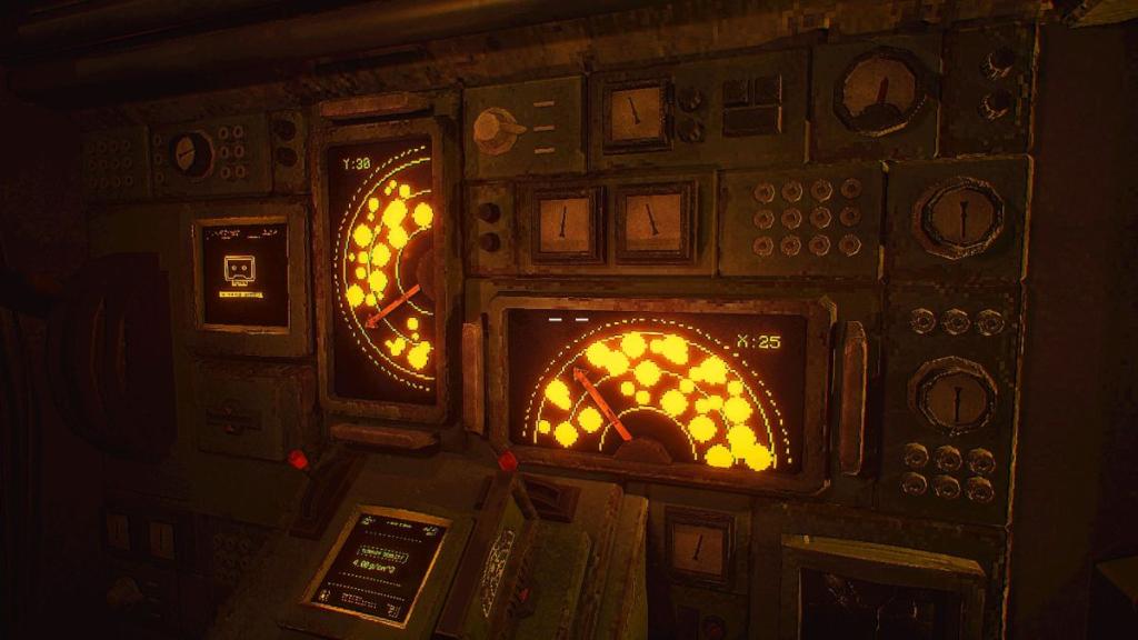
Once decrypted, the Navigation Cassette is reinserted into the main console, located on the left wall of the cockpit. This console features two smaller levers and associated displays. The objective here is to translate the decrypted seismic data into precise X and Y coordinates. This is achieved by carefully manipulating the two levers.
The displays above the levers present a visual representation of the subterranean strata, often depicting rock clusters and empty spaces. The navigator’s task is to position the levers so that they align with the empty spaces, creating a clear, unobstructed path through the geological formations. The guidance provided by an on-screen arrow is crucial in ensuring a straight trajectory through these void areas. Successful alignment of the levers with these empty spaces reveals the corresponding Y and X coordinates. These numerical values are then meticulously entered into the keypads located at the pilot’s seat, typically after activating the input mechanism with a red handle. This systematic approach ensures that the MOLE is directed towards its intended subterranean destination with absolute precision.
Navigating the Unknown: Piloting the Drill and Setting Optimal Speed
With the navigational coordinates securely inputted, the next critical phase involves preparing the MOLE for subterranean transit. This requires a thorough understanding of the drill’s operational parameters, particularly its speed, which is intrinsically linked to the geological conditions it will encounter.
The Terrain Density Chart: A Vital Analytical Tool
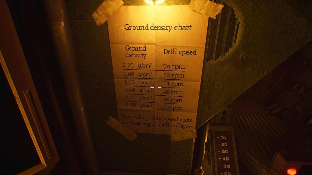
The Terrain Density display, adjacent to the Navigation Console, provides vital information about the ground density in g/cm³. This reading is not a direct input for drill speed but requires conversion using the Terrain Density Chart, a reference document typically located near the pilot’s seat. This chart establishes a correlation between the measured ground density and the optimal drill speed.
It is imperative to recognize that exact matches between density readings and drill speed recommendations are not always available. In such scenarios, the navigator must exercise judgment and interpolate values from the chart to determine the most appropriate speed setting. This chart should be consulted with every new set of coordinates acquired, as subterranean geological conditions can vary significantly.
Initiating Subterranean Travel
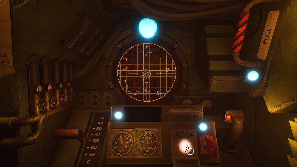
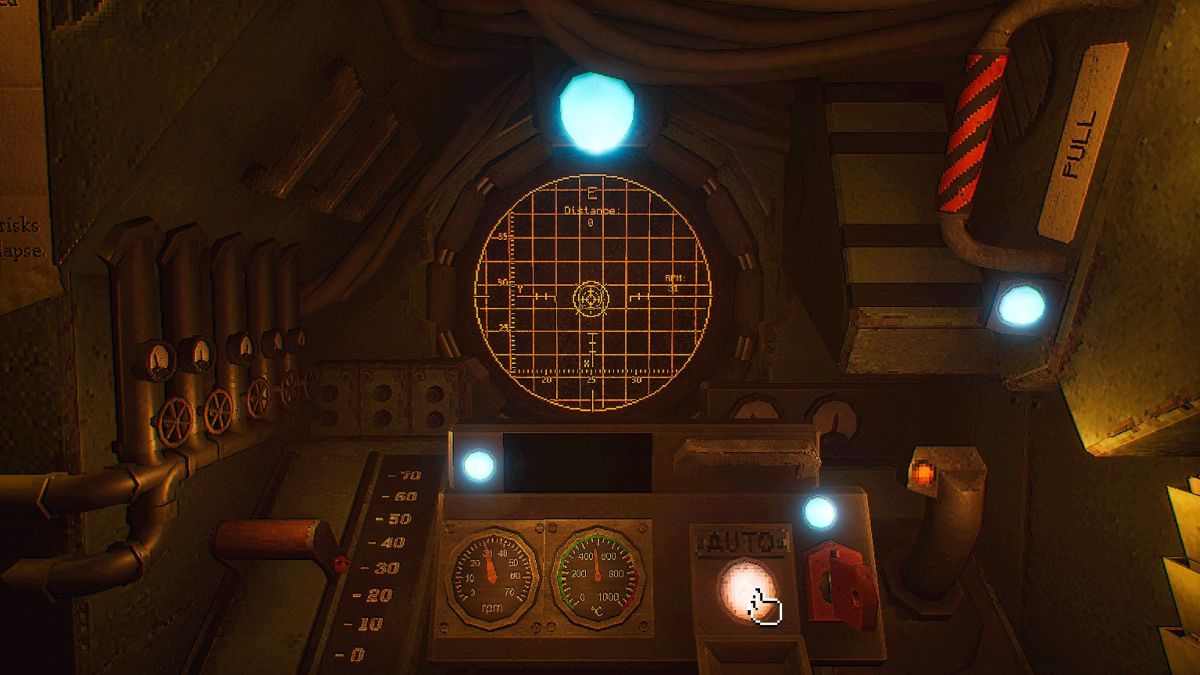
Upon determining the optimal speed, the navigator returns to the pilot’s seat. The red lever on the left of the seat is used to engage the drill and set the determined speed. Once the drill is operational, the navigation stick on the right becomes the primary control interface. The navigator must guide the MOLE, following the on-screen arrow displayed on the grid ahead. The objective is to align a piloting circle, controlled by the navigation stick, with a stationary circle representing the target destination.
When the piloting circle is precisely aligned with the destination circle, and the system indicates readiness, the "Auto" mode can be engaged by pressing the designated button. This transitions the MOLE to autonomous navigation, allowing it to proceed towards its objective with minimal further input. The successful transition to Auto mode signifies the accurate plotting of the course and the establishment of optimal drilling parameters.
Advanced Navigation: The Role of the Targeting Cassette
While the Navigation Cassette is fundamental to initial coordinate acquisition, a secondary but equally vital component for advanced piloting emerges on the second operational day with the opening of the Lab module: the Targeting Cassette. This cassette plays a crucial role in gathering specific signal data that complements the seismic information.
The White Rabbit Signal: Unlocking New Data Streams
The Targeting Cassette is utilized in conjunction with the "White Rabbit Signal," a unique data stream that requires specialized processing. The initial step involves retrieving a crystal from the Geologist’s workstation. This crystal must then be placed on the motherboard located beneath a monitor displaying the White Rabbit Signal.
To fully access the data, the cockpit lights must be extinguished. In this darkened environment, the navigator interacts with the White Rabbit Signal display. Prolonged observation of the signal results in visual feedback, typically manifesting as beams of light encircling a portion of the navigator’s vision. This indicates that the system is now calibrated to the signal’s unique frequency.
Following this visual calibration, the navigator turns to the wall behind them. With the lights still off, an interaction with a grid interface reveals the signal’s radio frequency. This frequency is typically presented in a numerical format, often broken into distinct segments.
Integrating Signal Data into Navigation
Upon returning the lights to their normal state, the Targeting Cassette is inserted into the radio unit. The top knob is used to set the first two digits of the radio frequency, while the bottom knob is adjusted to input the subsequent three digits. A small lever, often indicated by a red light, is then pulled to fine-tune the cassette’s reception and tune it to the specific frequency.
Once the Targeting Cassette is properly tuned, the navigator returns to the Cockpit. The computer terminal is then used to convert this newly acquired signal data into coordinates. This process typically involves selecting three files with the ".xyx" extension, often by pressing the Spacebar for each selection, followed by pressing Enter twice to confirm the input.
After this conversion, the resulting coordinates are integrated with the data obtained from the Navigation Cassette. The navigator then proceeds with the established protocol of using the Navigation Cassette, following the previously outlined steps to pilot the drill and plot the final course. This synergistic approach, combining seismic data with specialized signal intelligence, allows for more complex and potentially more rewarding missions.
Contextualizing MOLE Operations: A Broader Perspective
The MOLE project represents a significant undertaking in humanity’s efforts to secure vital resources and potentially discover new frontiers beneath the Earth’s surface. While the specific operational details are often couched in the language of gameplay mechanics, the underlying narrative suggests a critical need for subterranean exploration. This could be driven by dwindling surface resources, environmental challenges making surface extraction untenable, or the discovery of unique geological phenomena or extraterrestrial artifacts.
The phased introduction of operational elements, such as the availability of the Targeting Cassette on "day two," suggests a carefully designed progression of challenges and learning curves. This mirrors real-world technological development, where initial prototypes are often followed by more advanced iterations with enhanced capabilities. The reliance on decryption and the use of specialized cassettes point towards a sophisticated data security and retrieval system, ensuring that sensitive information remains protected.
The "White Rabbit Signal" itself is an intriguing element. In popular culture, the White Rabbit is often associated with leading characters down a path of discovery and into the unknown, a fitting metaphor for subterranean exploration. Its unique frequency and the need for specific calibration suggest a deliberate attempt to harness a particular type of energy or information. The implications of this signal could range from the detection of rare mineral deposits to the identification of geological anomalies that could pose future threats or offer unprecedented opportunities.
Analysis of Implications and Future Trajectory
The successful navigation and operation of the MOLE have profound implications for Earth’s future. By enabling access to previously unreachable subterranean resources, the MOLE could alleviate scarcity, fuel technological advancement, and potentially provide solutions to long-standing environmental challenges. The ability to precisely chart courses and adapt to varied geological conditions highlights a remarkable leap in autonomous drilling and exploration technology.
The cryptic nature of the initial directives, while presenting a gameplay challenge, also serves to emphasize the pioneering spirit of the MOLE program. It suggests that humanity is venturing into uncharted territory, both literally and figuratively, where established protocols may not yet exist. The navigator’s role, therefore, transcends mere operation; it is one of discovery, adaptation, and problem-solving in a high-stakes environment.
The continued development and deployment of MOLE technology will likely be a cornerstone of future resource management and exploration strategies. As more data is gathered and processed, the operational parameters of the MOLE will undoubtedly evolve, leading to even greater efficiency and expanded mission capabilities. The success of this program hinges on the navigator’s ability to master its complex systems, interpret its cryptic directives, and ultimately, steer humanity towards a more secure and prosperous future, deep beneath the surface of our planet.